- Ignore GTFS stops without coordinates (e.g., pathways nodes).
- Show alert when a regional analysis might be stalled.
- Show a loading indicator when waiting for single point analysis results.
- Require non-empty values in all name fields.
- Display upload errors and correct GeoTIFF handling for Data Sources.
April, 2022
We are pleased to announce the latest Conveyal release. New features in this release let you:
- View your network's street and transit layer details on a new map. Many users have requested this feature, and we are excited to finally release it!
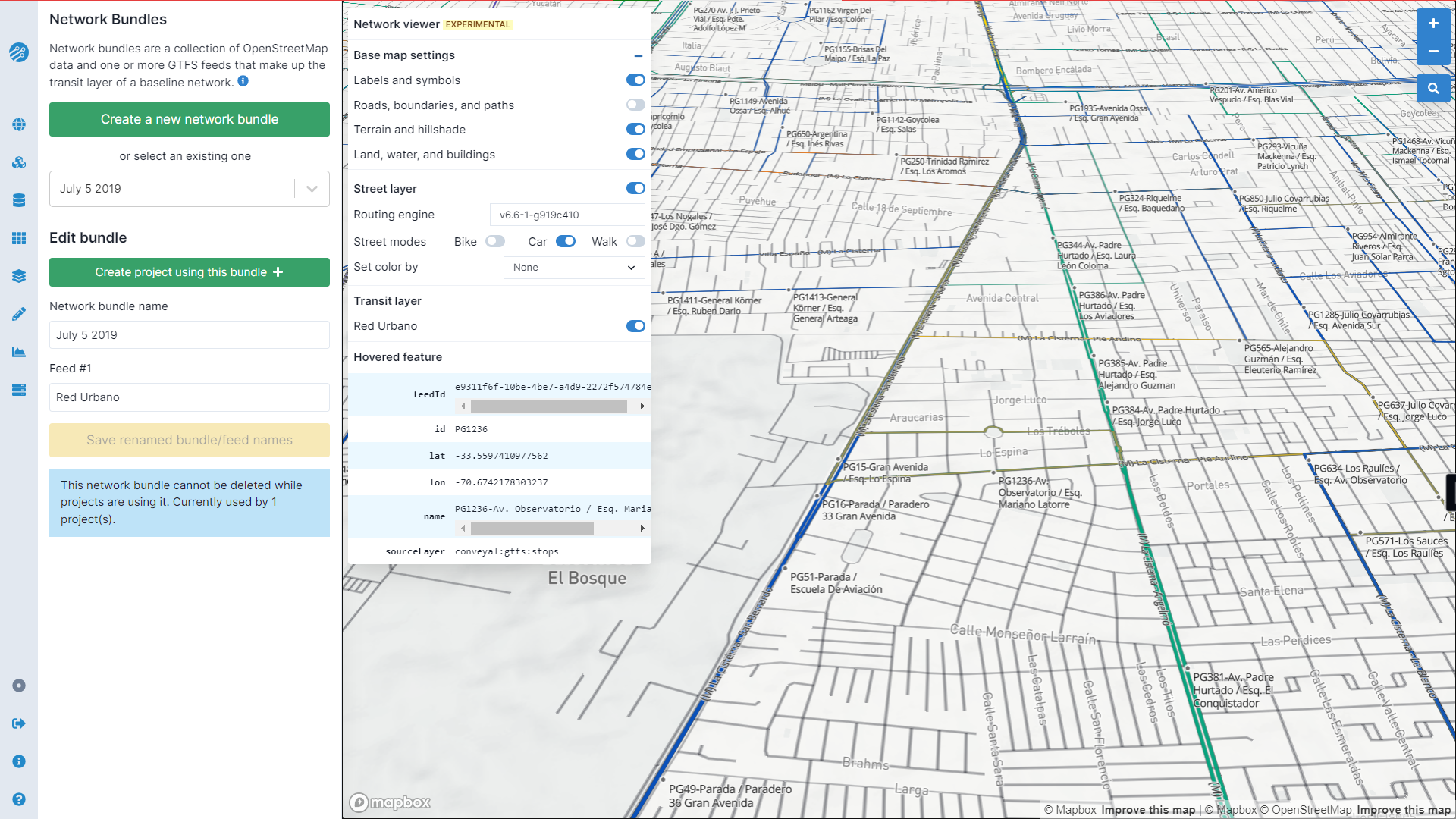
Network viewer
- Preview Data Sources on the map, and upload new data source types
- Use Data Sources in custom street modifications for road congestion, slope-adjusted biking times, ridehail service, custom cycling level of traffic stress, and more (experimental)
- Edit reroute modifications more easily, with less distracting auto-zoom behavior
Using a network bundle for the first time with the newly released routing engine (v6.7) may take a few moments, as a fresh network is built.
Additional improvements include:
February, 2022
We have a few upgrades and bugfixes to announce this month:
- Streamlined transit mode selector and support for extended GTFS
route_typevalues (👋 🚝 🚎). - Re-enabled JSON download of the scenario used in a regional analysis.
- Clearer errors when attempting to analyze a deleted project, scenario, or bundle, and better logical checks to prevent this error in the first place.
- Cleaner directional markers along modification alignments.