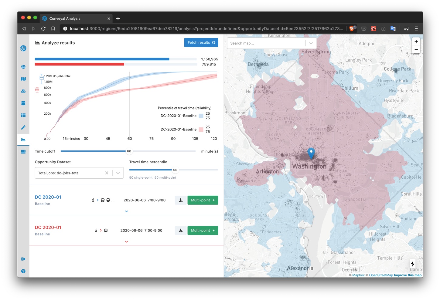
Comparison specific settings for single-point analyses
We revamped the single-point analysis page and added flexibility in how settings are configured. This change facilitates comparisons of access on different dates, by different modes, with different limits on number of transfers, etc.
Below is an example using the same scenario, but with transit modes other than bus disabled in the comparison analysis.
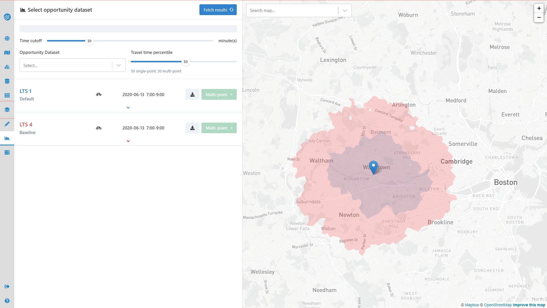
Level of Traffic Stress for analyzing bicycling comfort and safety
The analysis panel now includes a selector for maximum bicycle Level of Traffic Stress (LTS), ranging from 1 (low stress) to 4 (high stress). By default, LTS values for baseline street networks are calculated according to Conveyal's surrogate LTS methodology. You can also specify custom LTS for links in your networks with Street Modifications or by setting an lts= tag on uploaded OSM.
Below is an example of how far a cyclist comfortable with high-stress conditions (LTS 4) could travel in 30 minutes, compared to how far a cyclist comfortable only with low-stress conditions (LTS 1) could travel. Areas where the red LTS 4 isochrone extends much farther than the smaller LTS 1 isochrone indicate places to which conditions curtail access for cyclists who want safe, low-stress riding from this origin. Links between the origin and important destinations in large red areas might be good candidates for improved cycling infrastructure.
Experimental Street Modifications -- worker version v5.9.0 or higher required
Note: features marked as "experimental" may be subject to changes as we finalize features and optimize performance, so ongoing compatibility is not guaranteed. Feel free to try any experimental modifications, but be aware that they may need to be re-created to be compatible with future Conveyal versions.
We added two additional modifications for small-scale street network changes. With an Add Streets modification, you can add new links to the street network, such as pedestrian connections to stations, protected bicycle lanes, and bridges. With a Modify Streets modification you can model tunnel closures, slower speeds, and more.